Country

Cyclone Fani to hit Bangladesh tomorrow
Danger signal raised to no. 7 in Mongla and Payra ports
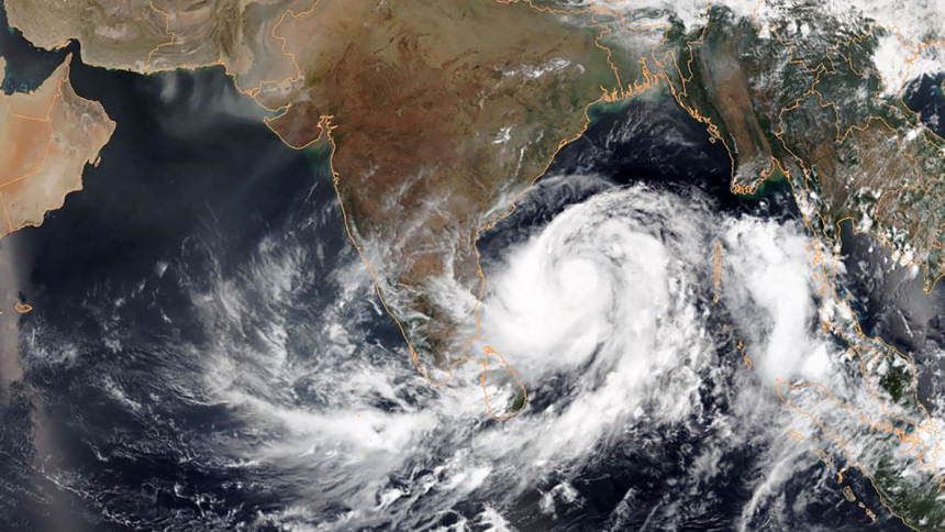
This May 1, 2019, satellite image obtained courtesy of the National Oceanic and Atmospheric Administration (NOAA) shows Tropical Cyclone Fani intensifying in the Bay of Bengal. Image taken from AFP

The severe cyclonic storm Fani will hit Bangladesh tomorrow, Bangladesh Meteorological Department said in its updated forecast this morning.

Khulna and adjacent districts are expected to witness the effects of Fani from tomorrow morning. By evening, the cyclone will reach southwestern districts.

Officials of the Met Office told The Daily Star this morning that Fani might arrive with wind speed from 150-180km per hour while crossing Bangladesh.

Meanwhile, the signal at Mongla and Payra ports have been raised to danger level 7. Chattogram port has been asked to hoist danger signal 6.

DANGER LEVEL AT DISTRICTS

Danger signal no. 7 has been hoisted across the coastal lines of Patuakhali, Bhola, Borguna, Barishal, Pirojpur Jhalakathi, Bagerhat, Khulna, and Satkhira.

Danger signal no. 6 has been hoisted across Chattogram, Noakhali, Laxmipur, Feni, Chandpur, said an updated cyclone warning of this morning.

The port of Cox’s Bazar has been asked to keep local warning signal no. 4.

Coastal districts of Chattogram, Noakhali, Laxmipur, Feni, Chandpur, Barguna, Bhola, Patuakhali, Barishal, Pirojpur, Jhalokathi, Bagerhat, Khulna, and Satkhira are likely to be inundated by surging tides of up to five-feet high.

THE CYCLONE HAS MOVED EAST

Last reported around 9:00am this morning, the eye of the cyclonic storm stood 1,065km southwest of Chattogram port and 925km southwest of Payra.
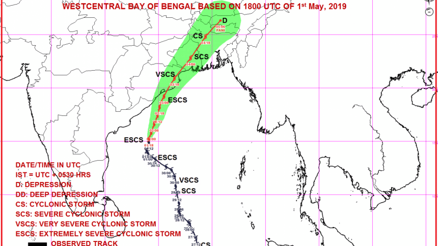
The projected track of severe cyclonic storm Fani updated on the morning of May 2, 2019. Photo: Indian Meteorological Department

The storm over west-central Bay moved north-northeastwards further over the same area, the special cyclone bulletin of Met Office said this morning.

The cyclone is likely to intensify further and move in a north-northeasterly direction, cross Odisha coast in India and then move towards West Bengal and gradually towards Khulna region of Bangladesh.

Comments