Climate Change

Sea-level rise in Bangladesh: Faster than global average
Government studies find
Sea-level rise in Bangladesh

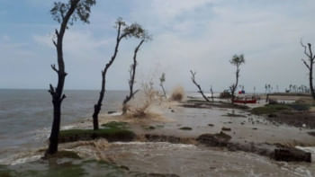
Bangladesh is experiencing a faster sea-level rise than the global average of 3.42mm a year, which will impact food production and livelihoods even more than previously thought, government studies have found.

Twelve coastal districts, where the impacts are expected to be severe, would be subjected to waterlogging, high salinity, crop damage, high temperatures, and excessive rainfall.

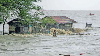
People will lose their homes, and poverty will increase, according to forecast studies, which were concluded recently but were yet to be made public.

The average annual sea-level rise for the Ganges tidal flood plain, the Meghna estuarine flood plain, and the Chittagong coastal plain is found to vary from 3.6mm to 4.5mm, 3.7mm to 4.1mm, and 3.1mm to 3.7mm between 1993 and 2019.

"Due to the present rates of local sea-level rise, more than 1 million people may be displaced," found the study titled "Estimation of Sea Level Rise (SLR) in Bangladesh using Satellite Altimetry Data" conducted by the Department of Environment.

Asked whether sedimentation was considered during the study, Prof AKM Saiful Islam, principal investigator of the study, said the study determined the trend of water level on Bangladesh's coast using satellite altimetry data.

He said they considered sedimentation and subsidence and still found the sea-level rise to be much faster than the global average.

He said the faster rate of rising sea-level on Bangladesh's coast will increase the vulnerability of coastal people and their livelihoods.

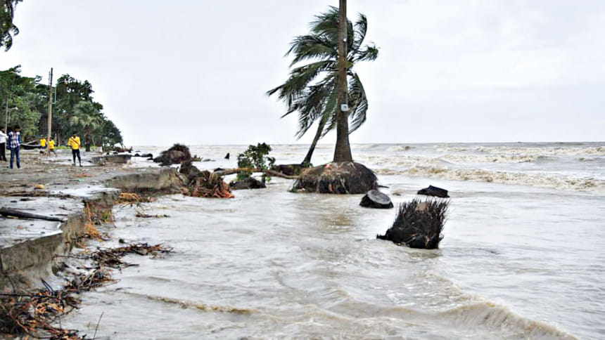
Salinity, coastal inundation, and storm surge height will increase. It could impact agriculture, food security, disaster management, health, drinking water supply, and coastal infrastructure.

The world's largest mangrove forest and its ecosystem will be affected by rising sea-level and salinity.

The DoE conducted a study on sea-level rise using tidal gauge data in 2016.
Climate crisis in Bangladesh

Project director of both studies, Mirza Shawkat Ali, director (climate change) at the DoE, said that experts had recommended validating the findings of the 2016 study using satellite altimetry data and assessing the impacts of sea-level rise.

The DoE then went for the study funded by the Bangladesh Climate Change Trust Fund and conducted by the Institute of Water and Flood Management of Bangladesh University of Engineering and Technology and Centre for Environmental and Geographical Services (CEGIS). Prof AKM Saiful Islam and Motaleb Hossain Sarker, director of CEGIS, led their teams in the study.

Researchers utilised data from satellite missions, like Nasa and the French aerospace agency's Topex/Poseidon, and its follow-up missions like Jason-1, Jason-2, and Jason-3, which track sea levels from space.

Focusing on the Bay of Bengal and Bangladesh, they employed Sen's slope (a non-parametric method used to estimate the magnitude and direction of trends in time series data) to discern overall trends in sea-level rise over time.

"There are a number of meticulously crafted maps that will serve as invaluable tools for policymakers, helping them identify priority areas for both short- and long-term adaptation strategies and risk management along Bangladesh's coastline," Mohan Kumar Das, one of the authors of the study, told The Daily Star yesterday.

IMPACT

The impacts of sea-level rise were also assessed through a study titled "Impacts of Projected Sea Level Rise on Water, Agriculture and Infrastructure Sectors of the Coastal Region".

The study projected the sea-level rise along the coastal belt of Bangladesh for 2030, 2050, 2070, and 2100 and assessed its impact on sectors.

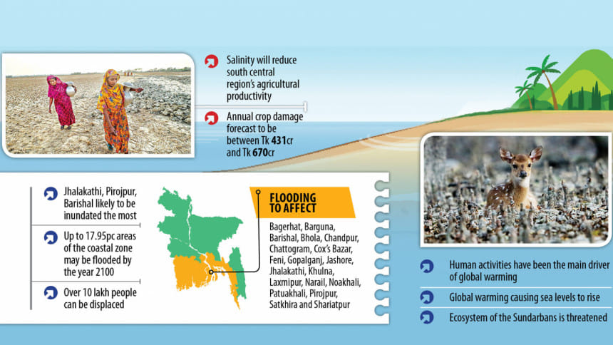
It found that sea level rise induced flooding will cover 12.34 percent to 17.95 percent of areas of the coastal zone by 2100.

The inundation will affect Bagerhat, Barguna, Barishal, Bhola, Chandpur, Chattogram, Cox's Bazar, Feni, Gopalganj, Jashore, Jhalakathi, Khulna, Laxmipur, Narail, Noakhali, Patuakhali, Pirojpur, Satkhira, and Shariatpur, the study found.

"In almost all future scenarios, Jhalakathi, Pirojpur, and Barishal will be most inundated, as most of them are not polder-protected... These districts are affected by the sea-level rise as they do not have a comprehensive flood protection system. The areas flooded are mostly inner coastal areas that are not protected by polders. So, the flood protection for these areas should be considered as a priority."

Polders are areas of lowland that have been separated by dykes to prevent water covering an area.

The study found that salinity levels will rise further inland. "The higher the SLR, the higher the salinity ingress in the coastal areas. This will affect mostly the south-central region heavily and reduce these regions' agricultural productivity."

The study also found that sea-level rise induced flooding will cause a 5.8 to 9.1 percent loss in Aman crop production.

"Barishal, Patuakhali, Jhalakathi, and Pirojpur districts are identified as the most vulnerable and affected areas where most damages occur. Some coastal regions had been saved from flooding by the existence of polders and embankments."

The study predicted that annual rainfall in coastal regions would be five percent to 16 percent higher between 2050 and 2080.

The temperature may increase by 1.4 degrees Celsius to 2.7 degrees Celsius in the 2080s.

The study suggested establishing automated tidal and surge gauges to regularly monitor sea-level rise.

Noted climate expert Ainun Nishat said that the sea-level rise resulting from global warming due to the melting of snow in the various mountains and from Antarctica, Greenland, and Iceland will be a major concern for Bangladesh.

Nishat, who reviewed the study "Impacts of Projected Sea Level Rise on Water, Agriculture and Infrastructure Sectors of the Coastal Region", said that in 60-70 years, low-lying deltaic areas of the southwestern region would face high salinity levels and may face higher levels of storm surges.

The districts in the central part of the country, like Gopalganj, Madaripur, Faridpur, Shariatpur, Pirojpur, and Jhalakathi, would need special protection against sea-level rise and increasing salinity.

"Already the water of Madhumati in Gopalganj is saline during the dry season."

Comments

Sea-level rise in Bangladesh: Faster than global average

Government studies find
Sea-level rise in Bangladesh

Bangladesh is experiencing a faster sea-level rise than the global average of 3.42mm a year, which will impact food production and livelihoods even more than previously thought, government studies have found.

Twelve coastal districts, where the impacts are expected to be severe, would be subjected to waterlogging, high salinity, crop damage, high temperatures, and excessive rainfall.

People will lose their homes, and poverty will increase, according to forecast studies, which were concluded recently but were yet to be made public.

The average annual sea-level rise for the Ganges tidal flood plain, the Meghna estuarine flood plain, and the Chittagong coastal plain is found to vary from 3.6mm to 4.5mm, 3.7mm to 4.1mm, and 3.1mm to 3.7mm between 1993 and 2019.

"Due to the present rates of local sea-level rise, more than 1 million people may be displaced," found the study titled "Estimation of Sea Level Rise (SLR) in Bangladesh using Satellite Altimetry Data" conducted by the Department of Environment.

Asked whether sedimentation was considered during the study, Prof AKM Saiful Islam, principal investigator of the study, said the study determined the trend of water level on Bangladesh's coast using satellite altimetry data.

He said they considered sedimentation and subsidence and still found the sea-level rise to be much faster than the global average.

He said the faster rate of rising sea-level on Bangladesh's coast will increase the vulnerability of coastal people and their livelihoods.

Salinity, coastal inundation, and storm surge height will increase. It could impact agriculture, food security, disaster management, health, drinking water supply, and coastal infrastructure.

The world's largest mangrove forest and its ecosystem will be affected by rising sea-level and salinity.

The DoE conducted a study on sea-level rise using tidal gauge data in 2016.

Climate crisis in Bangladesh

Project director of both studies, Mirza Shawkat Ali, director (climate change) at the DoE, said that experts had recommended validating the findings of the 2016 study using satellite altimetry data and assessing the impacts of sea-level rise.

The DoE then went for the study funded by the Bangladesh Climate Change Trust Fund and conducted by the Institute of Water and Flood Management of Bangladesh University of Engineering and Technology and Centre for Environmental and Geographical Services (CEGIS). Prof AKM Saiful Islam and Motaleb Hossain Sarker, director of CEGIS, led their teams in the study.

Researchers utilised data from satellite missions, like Nasa and the French aerospace agency's Topex/Poseidon, and its follow-up missions like Jason-1, Jason-2, and Jason-3, which track sea levels from space.

Focusing on the Bay of Bengal and Bangladesh, they employed Sen's slope (a non-parametric method used to estimate the magnitude and direction of trends in time series data) to discern overall trends in sea-level rise over time.

"There are a number of meticulously crafted maps that will serve as invaluable tools for policymakers, helping them identify priority areas for both short- and long-term adaptation strategies and risk management along Bangladesh's coastline," Mohan Kumar Das, one of the authors of the study, told The Daily Star yesterday.

IMPACT

The impacts of sea-level rise were also assessed through a study titled "Impacts of Projected Sea Level Rise on Water, Agriculture and Infrastructure Sectors of the Coastal Region".

The study projected the sea-level rise along the coastal belt of Bangladesh for 2030, 2050, 2070, and 2100 and assessed its impact on sectors.

It found that sea level rise induced flooding will cover 12.34 percent to 17.95 percent of areas of the coastal zone by 2100.

The inundation will affect Bagerhat, Barguna, Barishal, Bhola, Chandpur, Chattogram, Cox's Bazar, Feni, Gopalganj, Jashore, Jhalakathi, Khulna, Laxmipur, Narail, Noakhali, Patuakhali, Pirojpur, Satkhira, and Shariatpur, the study found.

"In almost all future scenarios, Jhalakathi, Pirojpur, and Barishal will be most inundated, as most of them are not polder-protected... These districts are affected by the sea-level rise as they do not have a comprehensive flood protection system. The areas flooded are mostly inner coastal areas that are not protected by polders. So, the flood protection for these areas should be considered as a priority."

Polders are areas of lowland that have been separated by dykes to prevent water covering an area.

The study found that salinity levels will rise further inland. "The higher the SLR, the higher the salinity ingress in the coastal areas. This will affect mostly the south-central region heavily and reduce these regions' agricultural productivity."

The study also found that sea-level rise induced flooding will cause a 5.8 to 9.1 percent loss in Aman crop production.

"Barishal, Patuakhali, Jhalakathi, and Pirojpur districts are identified as the most vulnerable and affected areas where most damages occur. Some coastal regions had been saved from flooding by the existence of polders and embankments."

The study predicted that annual rainfall in coastal regions would be five percent to 16 percent higher between 2050 and 2080.

The temperature may increase by 1.4 degrees Celsius to 2.7 degrees Celsius in the 2080s.

The study suggested establishing automated tidal and surge gauges to regularly monitor sea-level rise.

Noted climate expert Ainun Nishat said that the sea-level rise resulting from global warming due to the melting of snow in the various mountains and from Antarctica, Greenland, and Iceland will be a major concern for Bangladesh.

Nishat, who reviewed the study "Impacts of Projected Sea Level Rise on Water, Agriculture and Infrastructure Sectors of the Coastal Region", said that in 60-70 years, low-lying deltaic areas of the southwestern region would face high salinity levels and may face higher levels of storm surges.

The districts in the central part of the country, like Gopalganj, Madaripur, Faridpur, Shariatpur, Pirojpur, and Jhalakathi, would need special protection against sea-level rise and increasing salinity.

"Already the water of Madhumati in Gopalganj is saline during the dry season."

Comments

আমরা রাজনৈতিক দল, ভোটের কথাই তো বলব: তারেক রহমান

তিনি বলেন, কিছু লোক তাদের স্বার্থ হাসিলের জন্য আমাদের সব কষ্টে পানি ঢেলে দিচ্ছে।

১১ ঘণ্টা আগে