Tackling climate change in the Barind Tract

In almost every global assessment of which countries are most vulnerable to climate change impacts, Bangladesh comes out as either first or at least in the top five, depending on the criteria used in the assessment.
Thus, Bangladesh is now globally well known to be one of the most vulnerable countries to climate change. The government and people of Bangladesh are now in the process of changing that narrative to making Bangladesh into the most climate resilient country in the world.
As the impacts of climate change vary from place to place, methods of adaptations to tackle the impacts must also take local conditions into account. Thus the impacts in coastal Bangladesh will be different from the Haor basin in the north east which in turn will be different from the Barind Tract in the north-west of Bangladesh.
I was recently in Rajshahi and Bogra for a meeting with researchers, government officials, NGOs and other stakeholders working on the problems of the Barind Tract, so I will focus on what I saw there.
The first point to make is to describe the particular situation of the region and how it is vulnerable to climate change.
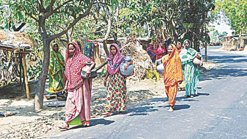
The region consists of two types of geology, namely the High Barind and the floodplain Barind. The former is a somewhat higher land which is dissected or undulating. A long time ago, the region had lots of forests and wild animals but over the last century, it lost most of its tree cover and became very dry and almost like a desert.
However, since the eighties, there has been a massive tree planting programme together with the discovery of underground water which could be used for irrigation of high-yielding rice, and the region has been transformed for the better in recent decades.
However, with climate change, predictions are that there would be far more erratic rainfall in future and the thousands of deep tube-wells that are being used are in danger of over-extracting the available groundwater. Hence, there clearly needs to be an emphasis on using less water requiring crops as well as more use of surface water wherever possible.
At the same time, the social and economic situation in the region has its own peculiarities with sizeable populations of Adivasis and also significant populations living in river islands called chars who are amongst the most vulnerable groups in the country.
Hence, the adaptation strategies that need to be adopted, and are already being piloted, need to both address changes in crops as well as focusing on the most vulnerable populations in the region.
Amongst the promising options being piloted are cattle rearing in the chars and mango orchards in the land which are showing positive results. However, one of the major bottlenecks is marketing the products, as seen this year with excess supply of potatoes which could not be sold. One promising option is to explore export markets for some of the products such as mangoes.
Another bottleneck that was identified was the lack of coordination and difficulty to scale up the many successful pilot activities. One concept that is being looked at to tackle this issue is Integrated Land Management (ILM) which brings together all the relevant actors working in the same landscape and tries to ensure synergies across them.
In conclusion, it is clear that the Barind Tract in North West Bangladesh is one of the most climate vulnerable zones of the country which will need special focus in future adaptation planning to transform it into a resilient Barind Tract.
A similar approach will also be needed in other vulnerable zones such as the coastal areas, haors, Hill Tracts and flood prone zones.
Saleemul Huq is Director, International Centre for Climate Change and Development at the Independent University, Bangladesh.


Comments