Google Maps adds new features for Bangladesh

Google, with its global to local approach, has introduced three new features for Bangladeshi users. Some of the features were made available for the local users recently but the formal announcement came today. In a press conference today, Google's regional officials showcased the new three features. Google also informed it has added more than 50,000KM of roads, more than 8 million buildings, and more than 600,000 points of interests on Google Maps across Bangladesh since January 2018.
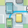
Of the three features, most prominent is probably a dedicated and new navigation mode for motorcycle riders. With the surge of ridesharing through two-wheelers, Bangladesh saw a 200% growth of two-wheelers in the country according to data by Bangladesh Road Transport Authority. Keeping in that very crowd in mind, Google also introduced this navigation mode. Previously, riders would need to do a mental calculation to estimate their arrival times based on a combination of walking and driving routes, but this new feature delivers more accurate estimated time of arrival to the destination based on machine learning models that reflect motorbike speeds. It also guides with the direction with the assistance of the Google Street View image for pre-trip planning. Another update rolling out today is turn-by-turn voice navigation in the local language. Now you can expect Google Maps to effortlessly tell you all the key roads and places in Bangla.
Lastly, Google Maps is introducing 'Stay safer' and 'Set off-route alerts' option. After searching for your destination and getting directions, you can enable this option so that if your vehicle deviates more than 0.5km from the Google Maps suggested route, your phone will buzz and you can tap in to see the deviation. You can also choose to share your live trip with friends and family directly from that screen so they know you are off route and can keep track of your journey.

 For all latest news, follow The Daily Star's Google News channel.




Comments