Climate loss

Rain falls at Greenland ice summit for first time on record
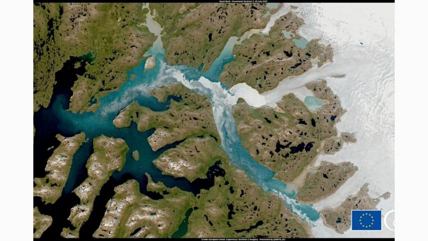
A satellite image shows Nuuk Fjord, Greenland July 29, 2021. European Union, Copernicus Sentinel-2 imagery - Processed by @DEFIS_EU/Handout via REUTERS

Rain fell at the highest point on the Greenland ice sheet last week for the first time on record, another worrying sign of warming for the ice sheet already melting at an increasing rate, scientists said on Friday.

"That's not a healthy sign for an ice sheet," said Indrani Das, a glaciologist with Columbia University's Lamont-Doherty Earth Observatory. "Water on ice is bad. … It makes the ice sheet more prone to surface melt."

Not only is water warmer than the usual snow, it's also darker -- so it absorbs more sunlight rather than reflecting it away.

That meltwater is streaming into the ocean, causing sea levels to rise. Already, melting from Greenland's ice sheet --the world's second-largest after Antarctica's -- has caused around 25% of global sea level rise seen over the last few decades, scientists estimate. That share is expected to grow, as global temperatures increase.

The rain fell for several hours at the ice sheet's 3,216-metre summit on August 14, where temperatures remained above freezing for around nine hours, scientists at the US National Snow and Ice Data Center said.

Temperatures at the ice cap almost never lift above freezing, but have now done so three times in less than a decade.

In total, 7 billion tonnes of rain fell across Greenland over three days, from August 14 through August 16 -- the largest amount since records began in 1950.

The rain and high temperatures triggered extensive melting across the island, which suffered a surface ice mass loss on August 15 that was seven times above the average for mid-August.

The record-breaking rain is the latest in a string of warning signs about how climate change is affecting Greenland's ice sheet.

Greenland experienced a massive melting event in late July, when enough ice melted in a single day to cover the US state of Florida in 2 inches (5 cm) of water.

That melting event and last week's rain were both caused by air circulation patterns which meant warm, moist air temporarily covered the island.

"This alarming rain at the summit of Greenland is not an isolated event," said Twila Moon, deputy lead scientist with the US National Snow and Ice Data Center.

Along with rising floods, fires, and other extremes, it is one of many "alarm bells" signalling the need to reduce greenhouse gas emissions, she said.

"We really have to stay laser-focused on adapting, as well as reducing the potential for those to become truly devastating."

Comments

বাংলাদেশের সংস্কার কর্মসূচি ও গণতান্ত্রিক রূপান্তরকে আল গোরের সমর্থন

সুইজারল্যান্ডের পাহাড়ি শহর দাভোসে বিশ্ব অর্থনৈতিক ফোরামের বার্ষিক সম্মেলনের ফাঁকে আল গোর অধ্যাপক ইউনূসের সঙ্গে সাক্ষাৎ করেন। এসময় তিনি ‘থ্রি জিরো’ আন্দোলনের প্রশংসা করেন।

৫১ মিনিট আগে