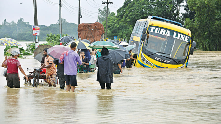
Floods In Bandarban, Cox’s Bazar: Heavy rain, urban sprawl to blame

The floods that hit Bandarban, Cox's Bazar and parts of southern Chattogram early this month left a trail of destruction in their wake.
Experts, locals and government officials have said excessive rainfall combined with several man-made factors caused the flood and took it to extreme levels.
Professor Alak Paul of geography and environmental studies department at Chittagong University said heavy rain and unplanned urbanisation are two major causes of the recent floods in the Chattogram division.
There was heavy rainfall at the beginning of August that coincided with a time of high tide, which hindered the rivers from carrying the floodwater into the Bay of Bengal.
Emdadul Haque, assistant meteorologist of Bandarban, said from August 1 to August 7 their office recorded 936 mm rainfall in Bandarban, which was around one and a half times as much as the expected rainfall in the region.
Following the rainfall, the flood inundated vast areas of the region from August 7 and continued till August 11.
"Influenced by the full moon on August 3, the level of water in the Bay of Bengal rose excessively for the following few days during the high tide, slowing down the receding of the floodwater in the region. Water could not flow out during the high tide, flooding thousands of households," said Dr Tanjir Saif Ahmed, executive engineer of Cox's Bazar Water Development Board.
Floodwater in the region recedes through three main rivers -- Sangu, Matamuhuri and Dalu -- all of which flow into the Bay of Bengal, he said.
He added that the river Matamuhuri flowing through Chakaria upazila in Cox's Bazar has lost its navigability as its excavation was done a long time ago.
The channel capacity of Matamuhuri river is 1,000 to 1,500 cubic metres per second, whereas the flow of recent flood water was around 2,200 cubic metres per second, which led to inundation, he said.
Water resource and climate change specialist Dr Ainun Nishat said these types of calamities will happen more frequently in the coming days. Navigability of the rivers can be raised by dredging or excavation to increase their water draining capacity as a short-term solution.
"We have to concentrate on long-term, sustainable solutions, including forestation. The government should sit with experts to find a way to address these types of natural disasters," he said.
AKM Jahangir, Sadar upazila chairman of Bandarban, told the Daily Star that unplanned urbanisation blocking the hilly streams and the plundering of trees from hills are two of the major reasons behind the severe flood in the district. Navigability of the rivers is being lost as mud washes away from the hills and deposits on the river bed due to the plundering of trees, he said.
Fazlul Karim Sayedi, chairman of Chakaria upazila, said some influential persons developed prawn enclosures blocking a main canal which had a major role in draining out flood water.
However, Nabi Hossain Chowdhury, chairman of Shaharbeel union of Chakaria, said five out of seven sluice gates in his area were clogged by waste and denied that prawn cultivation had anything to do with it.
Dr AKM Saiful Islam, professor at the Institute of Water and Flood management of Bangladesh University of Engineering and Technology said only 20 percent of waste gets collected and the rest of it ends up in the rivers, canals and drains, clogging the water flow. This contributes to flooding.
Referring to unplanned urbanisation, Arup Chakrabarty, executive engineer of WDB in Bandarban, said one of the causes of prolonged inundation is construction of some new roads and buildings that hinder water from flowing out.
This recent floods claimed 59 lives: 22 in Cox's Bazar, 20 in Chattogram, 10 in Bandarban and 7 in Rangamati.

 For all latest news, follow The Daily Star's Google News channel.


Comments