Explained
EXPLAINED

El Niño and La Niña

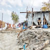
Photo: AFP

Thousands of kilometres away, the force of the wind and water temperature of the surface of the Pacific Ocean affect the climate we experience across the world. This is one of the world's most important climate processes – the El Niño Southern Oscillation (ENSO). 

What exactly is ENSO? 

ENSO is the system of interaction between water in the Pacific Ocean and the atmosphere above, measured in changes to sea surface temperatures and atmospheric pressure. There is a neutral state of ENSO, during which the interaction between water and air is normal, the winds aren't too weak or too strong, and the sea surface temperature is average – not too hot or too cold. Then, there are the two extreme states of ENSO – El Niño, when the winds are too weak and the water hotter than usual, and La Niña, when the winds are too strong and water colder than usual. 

Neutral ENSO: The way it's supposed to be 

Powerful winds, known as "trade winds", sweep across the equator, from east to west along the Pacific Ocean. The winds take the warm surface water along with them in the same direction, away from South America and towards Australia and Asia. 

The transition layer of the ocean between this surface warm water and cold deep water is called the thermocline. Here, the temperature changes abruptly. In the neutral state of ENSO, the thermocline is tilted. With more warm water now in the Western Pacific, the thermocline pushes down in the west and rises in the east. This process is called upwelling. The surface warm water is pushed away to the west, and other cold water comes up from below. This water tends richer in nutrients and is the reason behind the rich fisheries found on the west coast of South America. 

During the neutral phase, sea surface temperatures remain close to their long-term average. These conditions can last for years, but they are broken if they are pushed into one of two intense states, El Niño or La Niña. 

El Niño: The warm extreme 

El Niño occurs when the power of the trade winds, which in the neutral phase push surface warm water from east to west along the equator, weakens. Thus, little to no water is moved and remains on the Eastern and Central Pacific. The trade winds may even start blowing in the opposite direction, pushing warm water back east towards the west coast of the Americas. 

The thermocline in the east is pushed deeper and can completely flatten out. This puts a cap on the upwelling, as warm water hasn't moved away, cold water cannot move up to take its place. 

As cold water from the depths of the ocean tends to be richer in nutrients, the absence of it results in a decrease in fisheries along the coast of South America.

A global El Niño event is declared when sea surface temperatures rise at least 0.5 degrees Celsius in a region along the equator in the middle of the Pacific, known as Niño region 3.4. 

The oceans store up much more heat from global warming than the atmosphere does, and during El Niño, with more warm water at the surface, more heat can get out of the ocean. As a result, El Niño years are warmer worldwide. 

La Niña: The cool extreme 

Powerful trade winds, instead of weaker as in El Niño, get even stronger. Thus, they push more water, more than they usually do in the neutral state, west toward Asia. The thermocline becomes shallower in the Eastern Pacific, increasing upwelling of the coast of the Americas. More cold, nutrient-rich water is brought to the surface. 

A La Niña event is generally declared when sea-surface temperatures in Niño region 3.4 become 0.5 degrees Celsius colder than average. The number of fisheries off the coast of Peru increases. 

Episodes of El Niño and La Niña typically last nine to 12 months, but can sometimes last for years. El Niño and La Niña events occur every two to seven years, on average, but they don't occur on a regular schedule. Generally, El Niño occurs more frequently than La Niña.

Is climate change affecting El Niño and La Niña events? 

In 2021, the UN's climate scientists, the Intergovernmental Panel on Climate Change (IPCC), said that as of yet, there is no clear evidence that climate change has affected these events. While climate models do suggest that El Niño events will become more frequent and more intense as a result of global warming, potentially boosting temperatures further, but this is not certain.

How do El Niño and La Niña events affect the weather here in Bangladesh? 

The El Niño and La Niña events affect global temperatures, rainfall, tropical storms, and carbon dioxide levels. The hottest year to date, 2023, was a result of the combined effects of man-made global warming and the natural phenomenon of El Niño.

Last monsoon, rainfall was 67 per cent below the normal level, according to the Bangladesh Meteorological Department (BMD). This, along with the record-high temperatures, came at a huge cost to the livelihoods of farmers of Bangladesh. 

El Niño events are typically associated with increased rainfall in parts of southern South America, the southern United States, the Horn of Africa and Central Asia. In contrast, El Niño can cause severe droughts in Australia, Indonesia, and parts of southern Asia.

By properly tracking and analysing the phases of ENSO, it is possible to predict the upcoming temperatures, rainfall, and even any incoming climate catastrophes, saving lots of people from losses to their livelihoods. However, as of now, we have not yet invested in the infrastructure to analyse the El Niño and La Niña phases and their effects on Bangladesh. In the low-lying coastal region of Bangladesh with a significant dependence on the agricultural sector, this is long overdue.

Comments

মূল্যস্ফীতি

উচ্চ মূল্যস্ফীতির মধ্যেও বড় বাজেট

সরকার আগামী অর্থবছরের জন্য আট লাখ ৪৮ হাজার কোটি টাকার বাজেট পরিকল্পনা করছে, যা চলতি অর্থবছরের বাজেটের চেয়ে ৬ দশমিক ৩ শতাংশ বেশি।

১ ঘণ্টা আগে