Weather

Maritime ports advised to hoist cautionary signal 1
The depression may continue to move west-northwest, intensify, and turn into a cyclone. If it turns into a cyclone, it will be named "Dana"
Cyclone Dana update
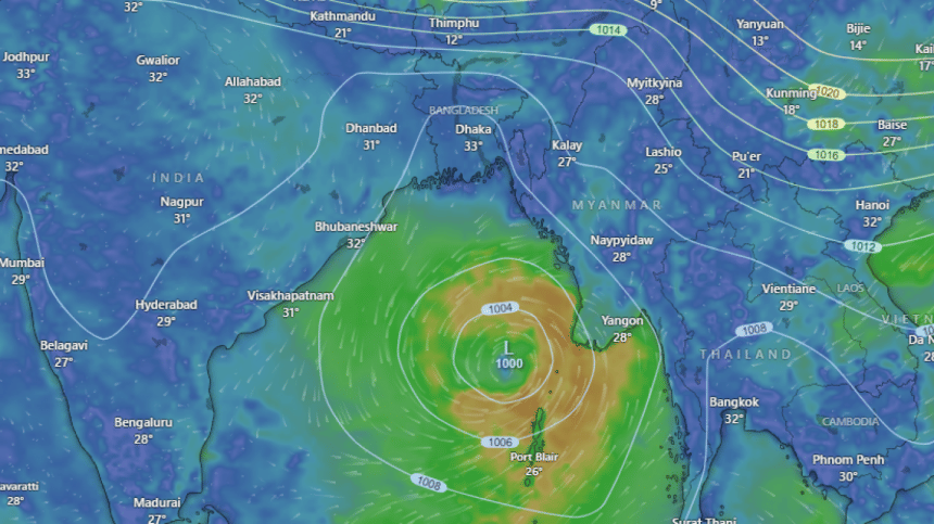
Screengrab from windy.com

The low-pressure area formed in the Bay of Bengal has intensified into a depression and may turn into a cyclone. According to today's weather bulletin, maritime ports of Chattogram, Cox's Bazar, Mongla and Payra have been advised to hoist distant cautionary signal one. All fishing boat and trawler over North Bay and deep sea have been advised to remain close to the coast and proceed with caution until further notice, so that they can take shelter as necessary.

The bulletin stated that the well-marked low-pressure area over the east-central Bay of Bengal and the adjoining north Andaman Sea has moved west-northwest and intensified into a depression in the same area.

As of 6:00am today, the depression was located 785 kilometers from Chattogram port, 700 kilometers from Cox's Bazar port, 820 kilometers from Mongla port, and 760 kilometers from Payra port.

The weather office further informed that the depression may continue to move west-northwest, intensify, and turn into a cyclone. If it turns into a cyclone, it will be named "Dana".

Temperatures across the country may increase slightly during the day and night today, and tomorrow the temperature may decrease by 1 to 3 degrees Celsius. The extended forecast for the next five days indicates that rainfall is expected to decrease during this period.

Across the border, India's eastern coast is bracing for the potentially severe cyclone as the depression is headed towards the coasts of four states, including Sagar Island in West Bengal.

In its latest bulletin, the India Meteorological Department (IMD) said that the well-marked low-pressure area over the east-central Bay of Bengal moved west-northwestwards, concentrated into a depression and lay centred at 730 km southeast of Paradip port in Odisha and 770 km from Sagar Island around 5:30am.

"It is very likely to move west-northwestwards and intensify into a cyclonic storm by tomorrow (October 23), over east-central Bay of Bengal," the bulletin said.

The depression will cross north Odisha and southern West Bengal coasts between Puri and Sagar Island in the early morning hours of Thursday (October 25) as a severe cyclonic storm with a wind speed of 100-110 kmph, gusting to 120 kmph, it said.

Advising fishermen not to venture into the sea from October 23 to 25, the IMD warned that wind speed is likely to reach 60 kilometre per hour (kmph) along and off Odisha-West Bengal coasts and gradually increase thereafter, our New Delhi correspondent reports citing the IMD.

Odisha chief minister Mohan Charan Majhi has said the state government is thoroughly prepared to address any challenges posed by Cyclone Dana.

Comments

আমরা রাজনৈতিক দল, ভোটের কথাই তো বলব: তারেক রহমান

তিনি বলেন, কিছু লোক তাদের স্বার্থ হাসিলের জন্য আমাদের সব কষ্টে পানি ঢেলে দিচ্ছে।

৪ ঘণ্টা আগে