How to track floods online

Due to the recent surge in rainfall, a risk of flooding has been reported in Sylhet, Sunamganj, Netrokona, and Moulvibazar districts for the next two days starting June 1, 2025, according to the Bangladesh Water Development Board (BWDB).
With water levels rising at an alarming rate, it is important to stay aware and cautious. Here are two ways users can track the flood:
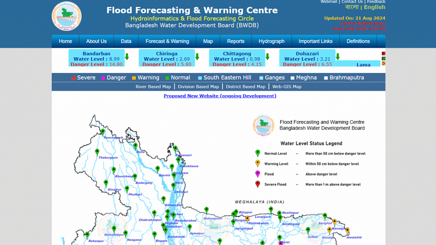
Flood Forecasting & Warning Centre (http://www.ffwc.gov.bd/) by Bangladesh Water Development Board (BWDB)
This website has river based, division based, district based and Web-GIS maps. These maps show water level status in 4 categories: Normal level (when water is more than 50 cm below danger level), warning level (when water is within 50 cm below danger level), flood (when water is above danger level) and severe flood (when water is more than 1 m above danger level).
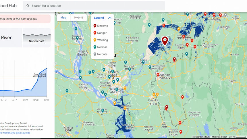
Google Flood Hub
Flood hub is an AI-based real-time global flood forecasting initiative by Google. Most of the flood forecasts rely on publicly available weather data from several sources like ECMWF forecasts, CPC rain gauge measurements, IMERG precipitation data, and satellite imagery from the European Space Agency's Copernicus Sentinel-1. Sentinel-1, a C-band SAR satellite, provides crucial imagery that our algorithms use to calculate flooded areas. However, in the case of Bangladesh, it uses local historical and real-time data from Bangladesh Water Development Board (BWDB).

 For all latest news, follow The Daily Star's Google News channel.





Comments