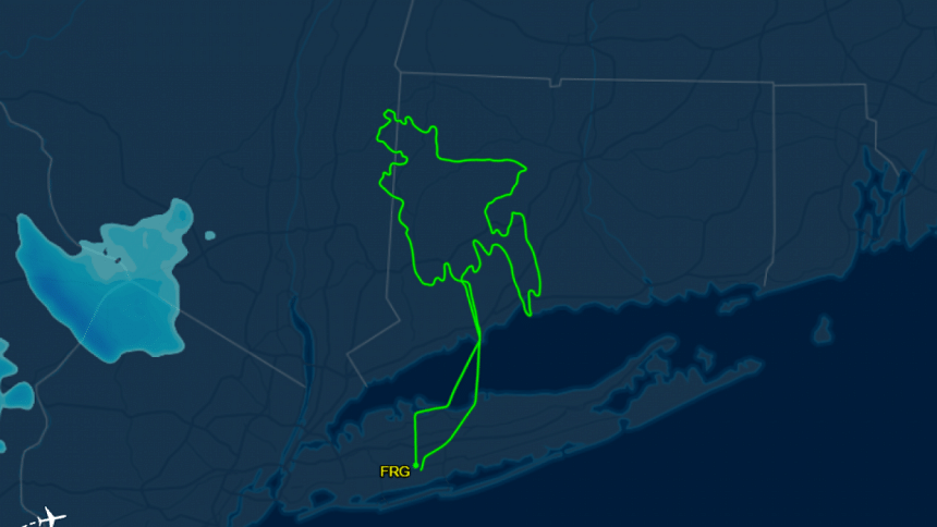
This pilot celebrated victory day drawing a map of Bangladesh in the sky

Fahim Chowdhury, a pilot, has drawn the map of Bangladesh in the sky using a Cessna 172 aircraft on the occasion of the 53rd Victory Day of Bangladesh.
According to his public post on Facebook, the flight duration was approximately 2 hours and 45 minutes, covering a total distance of 290 nautical miles.
In his post Fahim said, "From the cockpit, the sky felt like a canvas, and each turn was a tribute to the resilience and determination that define Bangladesh, honoring those who sacrificed for our independence."
According to FlightAware, a flight tracking and data platform, the flight began from Farmingdale, New York on December 14 at 11:16 PM EST and ended on December 15 at 01:54 AM EST (Bangladesh time: December 15 at 10:16 AM and ended on December 16 at 12:54 PM).

 For all latest news, follow The Daily Star's Google News channel.


Comments