Views

What does Bangladesh’s space research organisation really do?
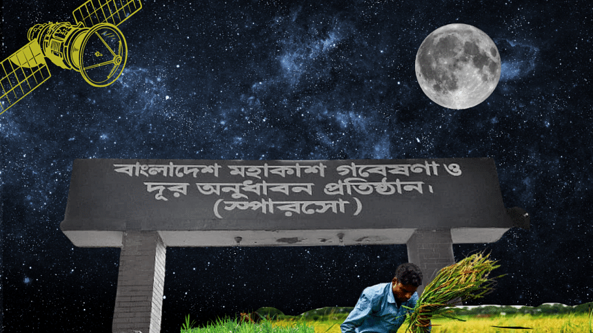
What does Bangladesh’s space research organisation really do? Visual: Teeni and Tuni

India's recent moon landing success raised a lot of curiosity and interest in Bangladesh and Pakistan. The question many people raised was: "Why couldn't we achieve something like this?" Bangladesh's Space Research and Remote Sensing Organisation (SPARRSO) came under scathing criticism from netizens.

Intrigued, I decided to find out more about SPARRSO from its website.

Founded in 1968 as the American space programme's Automatic Picture Transmission (APT) ground station, it is supposed to contribute to national development by peacefully applying space science and technology (vision statement). In 1972, when NASA launched its Earth Resources Technology Satellite (ERTS) – later renamed Landsat – SPARRSO continued active collaboration with it and later with Japanese and European space programmes.

That partnership has continued since. In May last year, NASA integrated its satellite data with observations from Bangladesh Meteorological Department (BMD) to enhance the country's ability to forecast extreme weather events. That means SPARRSO is active, but either it is not informing the public of its work or not meeting expectations. According to its website, SPARRSO had only two achievements in over 50 years: 1) NASA Group Achievement Award in 1986 and 2) Bangladesh Independence Award by its chairman in 1998. It offers only five data sets to the citizens, which are 33 years out-of-date (maps and images covering Dhaka, Chattogram, and Bangladesh, published between 1985 and 1990). There are only eight ongoing research programmes with a combined budget of just under Tk 88 lakh ($80,000 at the current exchange rate). With such a paltry allocation, we cannot expect any earth-shattering (or moon-shattering?) performance.

We, however, must be realistic. SPARRSO's mission is not necessarily sending lunar missions but using space technology for peaceful purposes. As such, it can focus on leveraging this technology and supporting Bangladesh's development journey. A few cases in other countries might clarify this point.

In 2012, India launched a programme called KisaanMitr (Farmers' Friend) to give farmers free personalised weather forecasts (from satellite data) and agricultural advice via SMS three times a day. Research showed that it led to greater compliance with agro-meteorological advisories in scheduling operations based on crop growth cycle. It also increased the use of rainwater as a groundwater or surface irrigation substitute.

In Brazil, the police hardly ever investigated environmental crimes because locating isolated illegal deforestation was difficult. In 2018, it adopted the online forest monitoring platform Global Forest Watch, which detects areas of tree cover loss using satellite imagery. With this, the police can quickly identify areas of illegal deforestation and combat them more effectively.

Senegalese farmers have improved their yields and reduced losses due to disease by monitoring crop health and identifying areas of crop stress with satellite imagery. The programme, in collaboration with the Global Partnership for Sustainable Development Data, uses Artificial Intelligence (AI) to predict crop yields and enhance food security by guiding the farmers, planning food storage and transport, and helping policymakers focus on the most vulnerable communities.

In Kenya, satellites map soil moisture levels with which farmers optimise their irrigation schedules. It improves crop yields and saves water, reducing the risk of crop failure due to drought. The Directorate of Resource Surveys and Remote Sensing (DRSRS) is working on a national digital programme for a satellite-based AI-powered crop monitoring and yield forecasting system. With it, the farmers will make smart and data-driven farming decisions, and monitor crops. Last year, Kenya joined UNCTAD's CropWatch programme to monitor its crops better and protect them from floods and other hazards. CropWatch uses satellite data to monitor crop conditions and integrates this with other climate-related data on drought, pests, and disease for better farm management.

None of these countries, save India, sent satellites into space but effectively uses data from others' satellites. Essentially, they collect relevant data from various sources, process them to produce useful information, and deliver the products effectively to the end users (e.g., farmers).

Aside from agriculture, there are many other fields where satellite imagery and advanced data processing can offer valuable insights. These include environmental conservation, disaster management, urban planning, infrastructure development, water resources management, public health management, and disease control. Each area can immensely benefit from satellite data but discussing them in a short article is impossible. Using satellite data effectively, Bangladesh can unlock space programmes' transformative potential for a more prosperous and sustainable future.

Here is a case. Landsat satellites cover the earth every 16 days and provide data for free downloading within a few minutes. However, such data are not precise as their pixel size is 30m (i.e., a 30x30m block on the ground becomes one number in the satellite data). These data cannot help in detailed studies that require higher precision. However, commercially available satellites offer accuracy in centimetres, even millimetres. These are expensive and not easily available. SPARRSO can act as a medium to procure such data and disseminate it to government and private users, charging a fee to recover the cost (making it commercially viable).

Bangladesh's space programme can indeed do a lot on the ground. But that needs sustained investment in education, research, joint programmes with universities and research organisations, technology transfer from advanced countries, and a long-term vision. Launching satellites is only one part of a space programme; the more significant part remains how the data is processed to glean valuable insights.


Dr Sayeed Ahmed is a consulting engineer and the CEO of Bayside Analytix, a technology-focused strategy and management consulting organisation.


Views expressed in the article are the author's own.


Follow The Daily Star Opinion on Facebook for the latest opinions, commentaries and analyses by experts and professionals. To contribute your article or letter to The Daily Star Opinion, see our guidelines for submission.

Comments

What does Bangladesh’s space research organisation really do?

What does Bangladesh’s space research organisation really do? Visual: Teeni and Tuni

India's recent moon landing success raised a lot of curiosity and interest in Bangladesh and Pakistan. The question many people raised was: "Why couldn't we achieve something like this?" Bangladesh's Space Research and Remote Sensing Organisation (SPARRSO) came under scathing criticism from netizens.

Intrigued, I decided to find out more about SPARRSO from its website.

Founded in 1968 as the American space programme's Automatic Picture Transmission (APT) ground station, it is supposed to contribute to national development by peacefully applying space science and technology (vision statement). In 1972, when NASA launched its Earth Resources Technology Satellite (ERTS) – later renamed Landsat – SPARRSO continued active collaboration with it and later with Japanese and European space programmes.

That partnership has continued since. In May last year, NASA integrated its satellite data with observations from Bangladesh Meteorological Department (BMD) to enhance the country's ability to forecast extreme weather events. That means SPARRSO is active, but either it is not informing the public of its work or not meeting expectations. According to its website, SPARRSO had only two achievements in over 50 years: 1) NASA Group Achievement Award in 1986 and 2) Bangladesh Independence Award by its chairman in 1998. It offers only five data sets to the citizens, which are 33 years out-of-date (maps and images covering Dhaka, Chattogram, and Bangladesh, published between 1985 and 1990). There are only eight ongoing research programmes with a combined budget of just under Tk 88 lakh ($80,000 at the current exchange rate). With such a paltry allocation, we cannot expect any earth-shattering (or moon-shattering?) performance.

We, however, must be realistic. SPARRSO's mission is not necessarily sending lunar missions but using space technology for peaceful purposes. As such, it can focus on leveraging this technology and supporting Bangladesh's development journey. A few cases in other countries might clarify this point.

In 2012, India launched a programme called KisaanMitr (Farmers' Friend) to give farmers free personalised weather forecasts (from satellite data) and agricultural advice via SMS three times a day. Research showed that it led to greater compliance with agro-meteorological advisories in scheduling operations based on crop growth cycle. It also increased the use of rainwater as a groundwater or surface irrigation substitute.

In Brazil, the police hardly ever investigated environmental crimes because locating isolated illegal deforestation was difficult. In 2018, it adopted the online forest monitoring platform Global Forest Watch, which detects areas of tree cover loss using satellite imagery. With this, the police can quickly identify areas of illegal deforestation and combat them more effectively.

Senegalese farmers have improved their yields and reduced losses due to disease by monitoring crop health and identifying areas of crop stress with satellite imagery. The programme, in collaboration with the Global Partnership for Sustainable Development Data, uses Artificial Intelligence (AI) to predict crop yields and enhance food security by guiding the farmers, planning food storage and transport, and helping policymakers focus on the most vulnerable communities.

In Kenya, satellites map soil moisture levels with which farmers optimise their irrigation schedules. It improves crop yields and saves water, reducing the risk of crop failure due to drought. The Directorate of Resource Surveys and Remote Sensing (DRSRS) is working on a national digital programme for a satellite-based AI-powered crop monitoring and yield forecasting system. With it, the farmers will make smart and data-driven farming decisions, and monitor crops. Last year, Kenya joined UNCTAD's CropWatch programme to monitor its crops better and protect them from floods and other hazards. CropWatch uses satellite data to monitor crop conditions and integrates this with other climate-related data on drought, pests, and disease for better farm management.

None of these countries, save India, sent satellites into space but effectively uses data from others' satellites. Essentially, they collect relevant data from various sources, process them to produce useful information, and deliver the products effectively to the end users (e.g., farmers).

Aside from agriculture, there are many other fields where satellite imagery and advanced data processing can offer valuable insights. These include environmental conservation, disaster management, urban planning, infrastructure development, water resources management, public health management, and disease control. Each area can immensely benefit from satellite data but discussing them in a short article is impossible. Using satellite data effectively, Bangladesh can unlock space programmes' transformative potential for a more prosperous and sustainable future.

Here is a case. Landsat satellites cover the earth every 16 days and provide data for free downloading within a few minutes. However, such data are not precise as their pixel size is 30m (i.e., a 30x30m block on the ground becomes one number in the satellite data). These data cannot help in detailed studies that require higher precision. However, commercially available satellites offer accuracy in centimetres, even millimetres. These are expensive and not easily available. SPARRSO can act as a medium to procure such data and disseminate it to government and private users, charging a fee to recover the cost (making it commercially viable).

Bangladesh's space programme can indeed do a lot on the ground. But that needs sustained investment in education, research, joint programmes with universities and research organisations, technology transfer from advanced countries, and a long-term vision. Launching satellites is only one part of a space programme; the more significant part remains how the data is processed to glean valuable insights.


Dr Sayeed Ahmed is a consulting engineer and the CEO of Bayside Analytix, a technology-focused strategy and management consulting organisation.


Views expressed in the article are the author's own.


Follow The Daily Star Opinion on Facebook for the latest opinions, commentaries and analyses by experts and professionals. To contribute your article or letter to The Daily Star Opinion, see our guidelines for submission.

Comments

জাহাজে ৭ খুন: ৪ দাবিতে বন্ধ হলো পণ্যবাহী নৌযান চলাচল

চাঁদপুরে মেঘনা নদীতে এম. ভি. আল-বাখেরা জাহাজের মাস্টারসহ সাত শ্রমিকের মৃত্যুর ঘটনার প্রকৃত কারণ উদঘাটন ও জড়িতদের গ্রেপ্তারের দাবিতে বাংলাদেশ নৌযান শ্রমিক ফেডারেশনের লাগাতার কর্মবিরতি শুরু হয়েছে।

২ ঘণ্টা আগে