Why we need spatial database on loss and damage
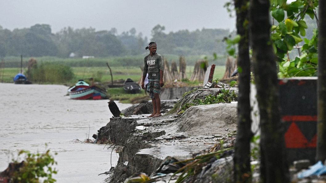
A ground-breaking agreement was reached at the 27th Conference of the Parties to the United Nations Framework Convention on Climate Change (COP27), to provide "loss and damage" assistance to vulnerable nations that have been severely affected by climate disasters. Developing nations rejoiced as critical climate negotiations came to a satisfactory completion with a "historic" consensus on their most important climate goal: a worldwide fund for "loss and damage" that would provide financial aid to underdeveloped countries affected by climate disasters.
A major concern in the distribution of funds for loss and damage for developing countries, especially Bangladesh, is the lack of archived data, data generation and management on the spatial scale. While there are several qualitative assessments and testimonials on the effects of various disasters that occur in the country, there is a big data gap due to the scarcity of quantitative numbers to support the damages and losses incurred. The lack of an integrated loss and damage assessment framework to analyse the impacts on local households and ecosystem is increasing the data gap. To correctly assess the extent of loss and damage in Bangladesh, to be able to receive the proper remuneration for it, a local multi-stakeholder-based assessment framework needs to be developed. Formulating our disaster risk reduction plan will also require such data.
With such diverse range of ecosystem like the hill tracts, the hoar basins and the Bay of Bengal on the South, different regions within Bangladesh need different assessment frameworks. Urban and rural areas are also affected differently; therefore, no region can be assessed with the same framework and criteria. To mitigate and adapt to these disasters, loss, damage, and conduct disaster risk reduction planning, accurate geospatial data are necessary.
Bangladesh needs a loss and damage assessment framework that is, therefore, community-led and is approved by the scientific and expert communities. The data developed within the loss and damage framework can be accurately used by both the national management organisations and internationally by other countries when providing relief and loss and damage funds to the country post a disaster. To accurately assess the data and develop quantifiable data and statistics, multiple assessment techniques need to be used.

Historical satellite data trends before and after a disaster can be used to analyse the extent of loss, damage and collect the data for the local regions. In addition to this, UAV/drone satellite data can easily identify the loss and damage of a particular region, for instance, the loss of agricultural land post a disaster. However, to collect data at the household level, we need to take a participatory approach and household survey approach at the local level and assess the impacts and damages incurred before and after a disaster. Quantitative surveys are important as they are able to assess individual losses at a ground level that enables effective policymaking and management plans at the national level. Acquiring data per household post each disaster on crops, infrastructure, livestock, fisheries and other ecosystems gives the most precise portrait of the loss and damage impacts on socio-environmental and economic livelihood of the households.
Information and Communication Technology (ICT) has become essential for data collection and management. Developing and using ICT platforms can make the data collection process much more effective and easily accessible. We need to develop a dashboard for particular disasters, which should include data on the loss and damage incurred per household from the disaster at a community scale. Developing and maintaining such a dashboard can not only help national disaster management and disaster risk reduction planning, but could also be useful for relief funds from international organisations and other developed and developing countries. Bangladesh needs support for institutional and capacity development training on the use of ICT on disaster management. Incorporating loss and damage management approaches in academic curriculum can provide better capacity and knowledge building for such management practices. Scientists say that it is important for disaster assessment to be rapid for easy recollection. Disaster databases should be updated promptly post a disaster, so no information is missed or incorrectly entered into the database.
Bangladesh Bureau of Statistics (BBS) has started to compile disaster related datasets (2020). They, however, lack data on the household level for particular disasters for each ecosystem. These databases should be strengthened to develop them at a national level. For this, there should be more disaster specific funds disseminated, and more small projects for disaster impacts should be implemented.
Implementation of a geo-spatial database by the government can address the impacts of loss and damage at community levels. Local administrative officers can play a significant role for digital database development and management. The officers can input the data for local regions on the national database, so all the regions are updated regularly. This will allow us to understand and assess the present and post-disaster conditions of the country, and help mitigate the loss and damages from climate change.
Md Nasir Uddin is research fellow at the Bangladesh Centre for Advanced Studies (BCAS) and country network manager at Cap-Net Bangladesh. Email: [email protected]

 For all latest news, follow The Daily Star's Google News channel.




Comments