Views

Robust tech-based response mechanism is needed to tackle flood
Robust tech-based response mechanism is needed to tackle flood
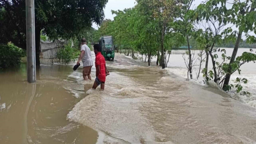
While flooding is not in the greater Mymensingh region, the frequency and intensity of the flood in recent times caught both residents and the local administration off guard. FILE PHOTO: MD AMINUL ISLAM

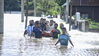
Bangladesh's Sherpur, Netrokona recently dealt with one of the worst floods after Feni. Massive regions have been swamped by consecutive floods, forcing thousands of residents to relocate and damaging infrastructure, houses, and crops. The flood in Sherpur claimed the lives of 11 persons in total. Hundreds of villages in the upazilas of Durgapur, Kalmakanda, Purbadhala, Barhatta, and Netrokona Sadar become immersed under water. Flash floods have left 67,520 people stranded in Bangladesh's Sherpur, Netrokona, and Mymensingh districts. About 20,000 hectares of Aman paddy have been damaged, and houses, highways, and several educational facilities have been inundated. According to the Sherpur district Fisheries Officer, fish from more than 2,000 fish enclosures have been washed away.

The flood caused food shortages, a lack of access to basic medical treatment, and serious damage to businesses and agricultural farms. The lack of available alleviation in the region was an issue. Despite the administration's claims of delivering aid, the aid offered was insufficient. Many people reported getting very little and frequently delayed aid. The relief measures highlighted the need for a more robust response mechanism. Local authorities have struggled to cope with the sheer scale of the disaster, and the lack of coordination among government agencies led to inefficient aid distribution. While flooding is not new to the region, the frequency of the flood in recent times and the intensity of the situation caught both residents and the local administration off guard, revealing critical gaps in flood preparedness and relief efforts.

The change in weather and climatic abnormalities necessitates reassessing disaster preparedness plans and highlights the importance of thorough risk assessments that these changes into account. The antiquated classifications for regions defined by their susceptibility to flooding or cyclones are no longer feasible as climate change continues to jeopardise weather patterns. Disasters can strike anywhere, any time as demonstrated by the changing climate, so all communities need to be ready. It is now more vital than ever to educate and raise awareness, especially in areas that were previously thought to be safe. Implementing regular drills and workshops can indeed create a culture of preparedness, ensuring that communities know how to act swiftly and effectively when disaster strikes. This not only helps in reducing panic but also ensures that the response is coordinated and efficient, ultimately saving lives. The agony experienced by those affected by the disaster is further exacerbated by the fact that it unfolded during a period of acute administrative dysfunction, after the recent fall of the Hasina government. The normal channels of coordination and communication—which are vital during emergencies—have collapsed due to the shakiness of the administrative framework.

The use of real-time observation to track and manage the changing situation is one of the crucial elements lacking in the existing flood response. Real-time information on resource requirements, impacted areas, and flood levels can offer crucial insights that facilitate speedier and more precise decision-making. Relief organisations frequently function in the dark without this knowledge, which causes resource misallocation and delayed responses in holding rescue operations and delivering critical services to those in need. In the absence of clear communication, multiple organisations may end up duplicating efforts in the same areas, while other regions remain underserved. This redundancy wastes valuable resources and time, reducing the overall impact of the relief efforts.

Right now, it is imperative to reclaim administrative functionality. Local disaster management committee restoration and strengthening must be the primary concern for the interim government. The interim government should temporarily establish an entirely distinct emergency management committee from the district to the union level. A coordinated response is contingent upon making sure these organisations have adequate resources, are staffed appropriately, and are running smoothly. By putting this decentralised approach to disaster management into practice, local authorities can react to crises more rapidly and efficiently.

Technology-based disaster management assistance may substantially enhance the efficacy and efficiency of responses, foremost when it comes to flooding. Especially in the context of floods, establishing community radio stations and setting up decentralised control rooms for emergency response are both essential stages in improving disaster preparedness and response. The government should invest in real-time flood monitoring systems, using satellite imagery, drones, and ground-level sensors to track flood levels, affected areas, and infrastructure damage. This data should be shared with all stakeholders—government agencies, NGOs, INGOs, and local communities—to ensure informed and rapid decision-making.

Decentralised control rooms allow for quicker, more responsive decision-making at the local level. These control rooms can be established in key locations across various districts and upazilas, enabling authorities to monitor the situation in real-time and respond more efficiently to the unique needs of each area. While these control rooms operate locally, they should be integrated into a national disaster management framework, allowing for a coordinated approach that can escalate support if the situation exceeds local capabilities.

Coordinating amongst various stakeholders, such as emergency services, volunteer groups, local government representatives, and non-governmental organisations, can be facilitated by each control room. This guarantees that resources are distributed effectively and that relief and rescue operations are coordinated. For imminent risk, real-time data integration is essential. Modern technology can be installed in control centres to combine information from multiple sources, including satellite photos, reports from the field, flood sensors, and weather forecasts.

Satellite data, weather radars, and predictive modeling can be used to monitor weather patterns and anticipate possible floods. Large-scale data can be analysed by machine learning algorithms to provide early warnings about flooding and rising water levels, allowing communities more time to plan and evacuate if required.

 A reliable mobile alert system should be established that notifies community people in at-risk areas in real time while offering instructions. Information concerning shelter locations, evacuation routes, and emergency contacts may be included in these alerts. Drones can take sharp photos and videos, which can be used to survey areas affected by flooding in real-time, to gather important information about the extent of the flooding, the damage to the infrastructure, and the areas that require immediate attention as well as planning rescue operations and allocating resources where they are most needed.

A unified relief database that tracks real-time relief distribution can prevent overlaps and ensure that aid reaches those in greatest need. The use of real-time data in this system would allow for dynamic adjustments to the relief strategy as the situation evolves. This centralised digital platform that connects all relevant stakeholders, including government agencies, NGOs, INGOs, and local organizations, is crucial. Decentralised control rooms and community radio stations are two doable, efficient ways to improve disaster management. By emphasising local capacity building and utilising technology, these programmes can guarantee that communities are more equipped to withstand and recover from future disasters.

Indeed, Bangladesh has come a long way in the last few decades in terms of disaster management, particularly with regard to managing cyclones and riverine floods. The country has developed early warning systems, built cyclone shelters, and improved its overall preparedness, reducing the number of casualties and the impact of such disasters. However, the recent flooding in the northern regions of the country has revealed critical gaps in the current disaster management framework, challenging the notion of whether is Bangladesh fully prepared for impending disasters anywhere, anytime, anyplace.


Monira Sharmin is a columnist and a member of Jatiya Nagorik Committee. She can be reached at monirasharmin111@gmail.com.


Views expressed in this article are the author's own. 


Follow The Daily Star Opinion on Facebook for the latest opinions, commentaries and analyses by experts and professionals. To contribute your article or letter to The Daily Star Opinion, see our guidelines for submission.


Comments

Robust tech-based response mechanism is needed to tackle flood

Robust tech-based response mechanism is needed to tackle flood
While flooding is not in the greater Mymensingh region, the frequency and intensity of the flood in recent times caught both residents and the local administration off guard. FILE PHOTO: MD AMINUL ISLAM

Bangladesh's Sherpur, Netrokona recently dealt with one of the worst floods after Feni. Massive regions have been swamped by consecutive floods, forcing thousands of residents to relocate and damaging infrastructure, houses, and crops. The flood in Sherpur claimed the lives of 11 persons in total. Hundreds of villages in the upazilas of Durgapur, Kalmakanda, Purbadhala, Barhatta, and Netrokona Sadar become immersed under water. Flash floods have left 67,520 people stranded in Bangladesh's Sherpur, Netrokona, and Mymensingh districts. About 20,000 hectares of Aman paddy have been damaged, and houses, highways, and several educational facilities have been inundated. According to the Sherpur district Fisheries Officer, fish from more than 2,000 fish enclosures have been washed away.

The flood caused food shortages, a lack of access to basic medical treatment, and serious damage to businesses and agricultural farms. The lack of available alleviation in the region was an issue. Despite the administration's claims of delivering aid, the aid offered was insufficient. Many people reported getting very little and frequently delayed aid. The relief measures highlighted the need for a more robust response mechanism. Local authorities have struggled to cope with the sheer scale of the disaster, and the lack of coordination among government agencies led to inefficient aid distribution. While flooding is not new to the region, the frequency of the flood in recent times and the intensity of the situation caught both residents and the local administration off guard, revealing critical gaps in flood preparedness and relief efforts.

The change in weather and climatic abnormalities necessitates reassessing disaster preparedness plans and highlights the importance of thorough risk assessments that these changes into account. The antiquated classifications for regions defined by their susceptibility to flooding or cyclones are no longer feasible as climate change continues to jeopardise weather patterns. Disasters can strike anywhere, any time as demonstrated by the changing climate, so all communities need to be ready. It is now more vital than ever to educate and raise awareness, especially in areas that were previously thought to be safe. Implementing regular drills and workshops can indeed create a culture of preparedness, ensuring that communities know how to act swiftly and effectively when disaster strikes. This not only helps in reducing panic but also ensures that the response is coordinated and efficient, ultimately saving lives. The agony experienced by those affected by the disaster is further exacerbated by the fact that it unfolded during a period of acute administrative dysfunction, after the recent fall of the Hasina government. The normal channels of coordination and communication—which are vital during emergencies—have collapsed due to the shakiness of the administrative framework.

The use of real-time observation to track and manage the changing situation is one of the crucial elements lacking in the existing flood response. Real-time information on resource requirements, impacted areas, and flood levels can offer crucial insights that facilitate speedier and more precise decision-making. Relief organisations frequently function in the dark without this knowledge, which causes resource misallocation and delayed responses in holding rescue operations and delivering critical services to those in need. In the absence of clear communication, multiple organisations may end up duplicating efforts in the same areas, while other regions remain underserved. This redundancy wastes valuable resources and time, reducing the overall impact of the relief efforts.

Right now, it is imperative to reclaim administrative functionality. Local disaster management committee restoration and strengthening must be the primary concern for the interim government. The interim government should temporarily establish an entirely distinct emergency management committee from the district to the union level. A coordinated response is contingent upon making sure these organisations have adequate resources, are staffed appropriately, and are running smoothly. By putting this decentralised approach to disaster management into practice, local authorities can react to crises more rapidly and efficiently.

Technology-based disaster management assistance may substantially enhance the efficacy and efficiency of responses, foremost when it comes to flooding. Especially in the context of floods, establishing community radio stations and setting up decentralised control rooms for emergency response are both essential stages in improving disaster preparedness and response. The government should invest in real-time flood monitoring systems, using satellite imagery, drones, and ground-level sensors to track flood levels, affected areas, and infrastructure damage. This data should be shared with all stakeholders—government agencies, NGOs, INGOs, and local communities—to ensure informed and rapid decision-making.

Decentralised control rooms allow for quicker, more responsive decision-making at the local level. These control rooms can be established in key locations across various districts and upazilas, enabling authorities to monitor the situation in real-time and respond more efficiently to the unique needs of each area. While these control rooms operate locally, they should be integrated into a national disaster management framework, allowing for a coordinated approach that can escalate support if the situation exceeds local capabilities.

Coordinating amongst various stakeholders, such as emergency services, volunteer groups, local government representatives, and non-governmental organisations, can be facilitated by each control room. This guarantees that resources are distributed effectively and that relief and rescue operations are coordinated. For imminent risk, real-time data integration is essential. Modern technology can be installed in control centres to combine information from multiple sources, including satellite photos, reports from the field, flood sensors, and weather forecasts.

Satellite data, weather radars, and predictive modeling can be used to monitor weather patterns and anticipate possible floods. Large-scale data can be analysed by machine learning algorithms to provide early warnings about flooding and rising water levels, allowing communities more time to plan and evacuate if required.

 A reliable mobile alert system should be established that notifies community people in at-risk areas in real time while offering instructions. Information concerning shelter locations, evacuation routes, and emergency contacts may be included in these alerts. Drones can take sharp photos and videos, which can be used to survey areas affected by flooding in real-time, to gather important information about the extent of the flooding, the damage to the infrastructure, and the areas that require immediate attention as well as planning rescue operations and allocating resources where they are most needed.

A unified relief database that tracks real-time relief distribution can prevent overlaps and ensure that aid reaches those in greatest need. The use of real-time data in this system would allow for dynamic adjustments to the relief strategy as the situation evolves. This centralised digital platform that connects all relevant stakeholders, including government agencies, NGOs, INGOs, and local organizations, is crucial. Decentralised control rooms and community radio stations are two doable, efficient ways to improve disaster management. By emphasising local capacity building and utilising technology, these programmes can guarantee that communities are more equipped to withstand and recover from future disasters.

Indeed, Bangladesh has come a long way in the last few decades in terms of disaster management, particularly with regard to managing cyclones and riverine floods. The country has developed early warning systems, built cyclone shelters, and improved its overall preparedness, reducing the number of casualties and the impact of such disasters. However, the recent flooding in the northern regions of the country has revealed critical gaps in the current disaster management framework, challenging the notion of whether is Bangladesh fully prepared for impending disasters anywhere, anytime, anyplace.


Monira Sharmin is a columnist and a member of Jatiya Nagorik Committee. She can be reached at monirasharmin111@gmail.com.


Views expressed in this article are the author's own. 


Follow The Daily Star Opinion on Facebook for the latest opinions, commentaries and analyses by experts and professionals. To contribute your article or letter to The Daily Star Opinion, see our guidelines for submission.


Comments

টাকা দিয়েও মালয়েশিয়া যেতে না পারায় মন্ত্রণালয়ের সামনে বিক্ষোভ

দুপুর পৌনে ১২টার দিকে তারা কারওয়ানবাজার থেকে মন্ত্রণালয়ের উদ্দেশ্যে রওনা দেন।

৩২ মিনিট আগে